
Llano de Chajnantor Observatory

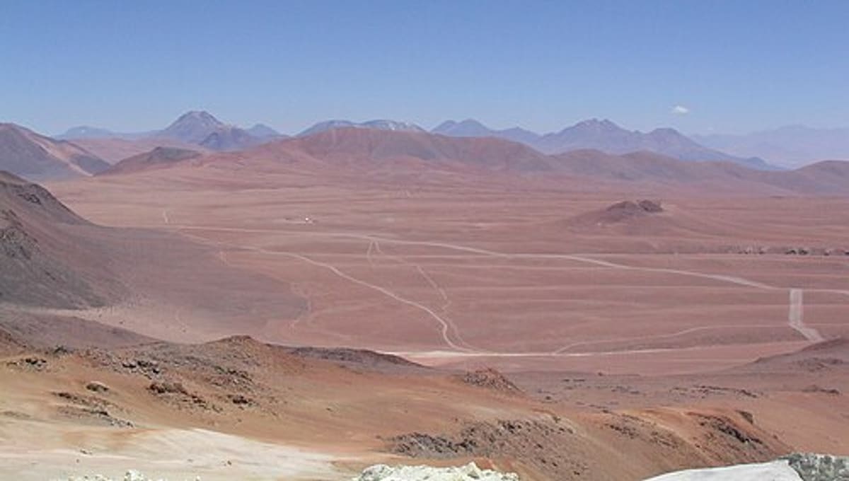
Image: Wikimedia Commons
Llano de Chajnantor Observatory is a cluster of astronomical facilities perched above 4,800 metres in the Atacama Desert of northern Chile, roughly 50 kilometres east of San Pedro de Atacama.
About Llano de Chajnantor Observatory
The name covers a group of observatories rather than a single building, sharing an extraordinarily dry, high-altitude site in Chile's Antofagasta Region. The thin, arid air here is inhospitable to people but ideal for astronomy, since water vapour is what normally absorbs and weakens submillimetre radiation from space.
History
The site began operating in 1999 and has since grown into one of the most important astronomical locations on Earth. In recognition of its scientific value, the Chilean government has designated Llano de Chajnantor and its surroundings as the Chajnantor Science Reserve.
Telescopes & research
Llano de Chajnantor is best known as the home of the Atacama Large Millimeter Array (ALMA), the largest and most expensive ground-based astronomical telescope project ever built. Its dozens of linked antennas study the universe at millimetre and submillimetre wavelengths, work that is only possible thanks to the site's exceptional dryness.
Location & getting there
The observatory sits in the Antofagasta Region of northern Chile, at an elevation of 4,800 metres, east of the small town of San Pedro de Atacama. Use the map on this page to plan the route from San Pedro; the altitude and remoteness mean this is a serious high-desert expedition, not a casual roadside stop.
Visiting Llano de Chajnantor Observatory
Given the extreme elevation and the sensitivity of the scientific work here, access is tightly controlled. Check the current visitor policy through official ALMA or Chajnantor channels, or a recent web search, before planning any trip to the site.
See your named star from here
Few places on Earth offer skies as dark and dry as the Atacama Desert around Chajnantor. If you have a Star Register certificate, its precise coordinates can guide a telescope toward your named star from anywhere with clear Atacama skies. Name a star or explore the catalogue to see stars our community has already named.
Opening hours and public-visit programs vary by season. Check Google Maps for current times before you travel.
Institutional and reference sources used to verify this guide.
Satellite imagery: Esri, Maxar, Earthstar Geographics
Tolar astronomical observatory
astronomical observatory in Salta Province, Argentina

 321 km
 323 km
 323 km