
Instituto Geofísico de la Escuela Politécnica Nacional
Satellite imagery: Esri, Maxar, Earthstar Geographics
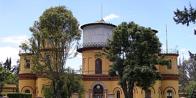
The Instituto Geofísico de la Escuela Politécnica Nacional in Quito, Ecuador, is the country's official body for monitoring seismic and volcanic hazards.
About the Instituto Geofísico
Founded in 1983 under the National Polytechnic School (Escuela Politécnica Nacional), the institute was given official state responsibility for hazard monitoring by Ecuadorian decree No. 3593 in January 2003. It runs real-time instrumental monitoring of active volcanoes and tectonic faults, and administers Ecuador's National Data Center for seismic, geophysical and tsunami information.
History
In 1992 the institute received the United Nations Sasakawa Prize for the best disaster mitigation work carried out worldwide during 1991, recognition of its role in protecting Ecuadorian communities from geological hazards.
Telescopes & research
Its ongoing monitoring covers key volcanoes including Tungurahua, Reventador, Guagua Pichincha, Cotopaxi and Sangay, using real-time instrumentation to track seismic and volcanic activity.
Location & getting there
The institute is based in Quito, Ecuador, the country's capital, high in the Andes.
Visiting the Instituto Geofísico
Note this is a geophysical monitoring institute, not an astronomical observatory. Check its official website for current information before planning any visit.
See your named star from here
Quito's high-altitude Andean location can offer clear night skies. If you've named a star, its coordinates from the star catalogue can help you find it with any telescope during a visit to the region.
Opening hours and public-visit programs vary by season. Check the official website and Google Maps for current times before you travel.
Institutional and reference sources used to verify this guide.
Satellite imagery: Esri, Maxar, Earthstar Geographics

 1 km
1 km
 1,040 km