
Qaanaaq (Thule) Magnetic Observatory
Satellite imagery: Esri, Maxar, Earthstar Geographics
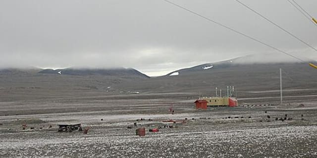
At the top of the world in Qaanaaq, North West Greenland, a geomagnetic observatory has kept watch on the planet's magnetic field since the 1950s, far closer to the pole than almost any other station of its kind.
About Qaanaaq (Thule) Magnetic Observatory
The Qaanaaq, or Thule, Magnetic Observatory is a geophysical research station in Qaanaaq, North West Greenland, operated by DTU Space. It sits at a magnetic latitude of roughly 85 degrees, among the highest of any geomagnetic observatory on Earth, and is staffed year-round by a local full-time manager.
History
The observatory was established in the 1950s as part of the effort to monitor Earth's magnetic field from the high Arctic, a location that offers a uniquely clear window on activity in the northern polar cap.
Telescopes & research
Rather than optical telescopes, the station's instruments track geomagnetic and infrasound activity, feeding into multidisciplinary geophysical research. Its data helps determine the Polar Cap index, used to monitor northern polar cap activity and anti-sunward plasma convection.
Location & getting there
Qaanaaq is a remote settlement in North West Greenland, one of the northernmost inhabited places on Earth, and the observatory's high-latitude position is central to the scientific value of its measurements.
Visiting Qaanaaq (Thule) Magnetic Observatory
As a working scientific monitoring station rather than a visitor attraction, the observatory is not generally open to the public; travel to Qaanaaq itself requires advance planning given its remote Arctic location.
See your named star from here
Qaanaaq's position near the magnetic pole is prized for geophysics, not stargazing, but the same remoteness that keeps its instruments free of interference also gives its clear polar nights very dark skies. A star named through Star Register carries the same kind of precise coordinates, right ascension and declination, that scientists here use to describe positions in the sky above. Browse our naming packages or search the catalogue.
Opening hours and public-visit programs vary by season. Check Google Maps for current times before you travel.
Institutional and reference sources used to verify this guide.
Satellite imagery: Esri, Maxar, Earthstar Geographics

 568 km
China-Iceland Arctic Science Observatory
joint Chinese-Icelandic polar science facility