
Saint-Malo marigraph

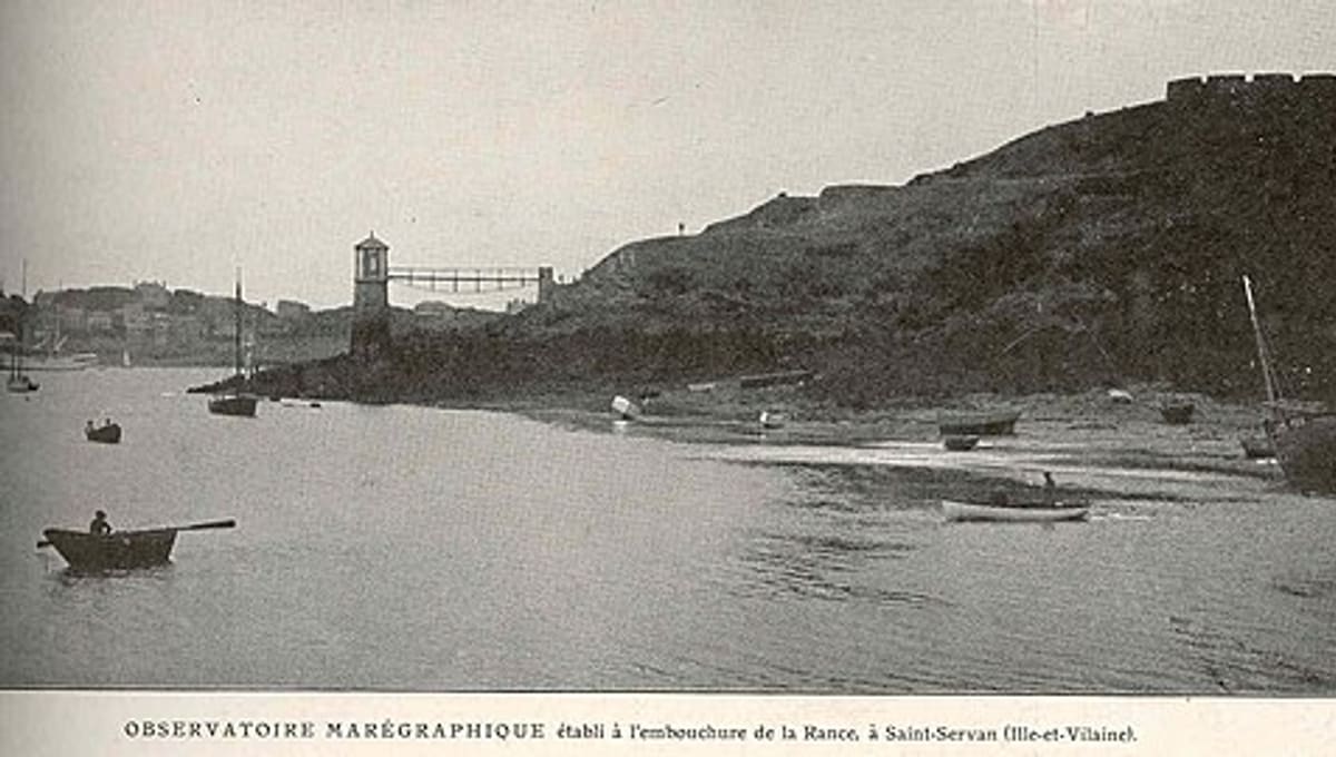
Image: Wikimedia Commons
At the Solidor inlet in Saint-Malo, France, the Saint-Malo marigraph is a tide gauge station with roots stretching back to the early 19th century.
About Saint-Malo Marigraph
Early tide observations at Saint-Malo began in the 1830s using scales near the Solidor inlet, continuing until the early 1850s. A Chazallon float-type marégraphe was installed in 1850 in a purpose-built octagonal tower constructed by the French Navy's hydraulic services.
History
The station was operated by SHOM, the French Hydrographic and Oceanographic Service, with tide observers recording data until 1917. It later received modern upgrades, including an Optiwave sensor in 2009 and a Campbell system with meteorological sensors in 2021, and it remains an active station today.
Location & getting there
The marigraph sits at the Solidor inlet in Saint-Malo, on the Brittany coast of France, a historic walled port town on the English Channel.
Visiting Saint-Malo Marigraph
The marigraph is a working scientific installation within the SONEL and PSMSL sea-level monitoring networks rather than a staffed visitor site, though its octagonal tower can be seen from the Solidor inlet area of Saint-Malo.
See your named star from here
Saint-Malo's clear Channel-coast nights are a memorable place to look for the coordinates behind a named star certificate, even if this particular station keeps watch on the tides rather than the stars. Explore more named stars in our catalogue.
Opening hours and public-visit programs vary by season. Check Google Maps for current times before you travel.
Institutional and reference sources used to verify this guide.
Satellite imagery: Esri, Maxar, Earthstar Geographics

 244 km
 282 kmRadio
 302 kmMuseum
Herstmonceux Science Centre
building complex in Herstmonceux, East Sussex, England, UK